7 days
Specific Tour
16 people
___
Pangarchulla Trek is one of the most thrilling high-altitude treks in the Garhwal Himalayas, combining dense forests, alpine meadows, snow-covered ridges, and dramatic summit climbs into a truly unforgettable Himalayan adventure. Rising to an elevation of approximately 15070 ft above sea level, the trek covers nearly 38 km and is usually completed over 7 days, including proper acclimatization.
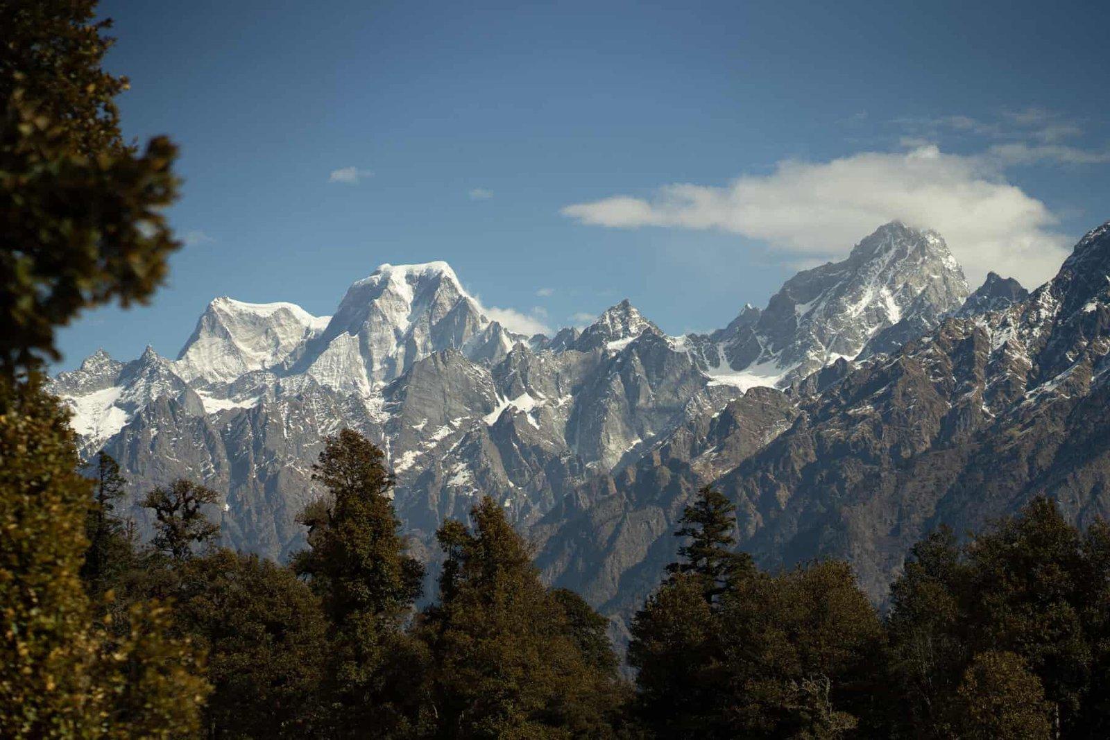
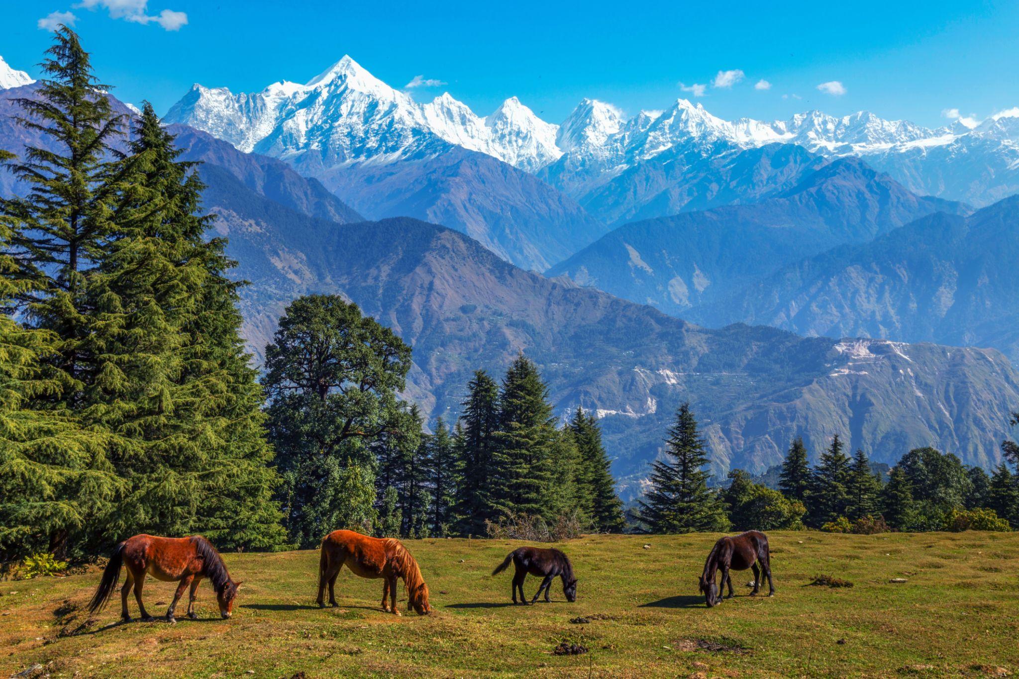
Located in the heart of Uttarakhand, the trek is renowned for its spectacular mountain scenery and adventurous terrain. The trail begins through lush oak and rhododendron forests before gradually opening into vast alpine meadows and snow-covered slopes. During spring, blooming rhododendrons add vibrant colors to the landscape, while higher sections of the trek remain blanketed in snow, creating a breathtaking Himalayan setting.
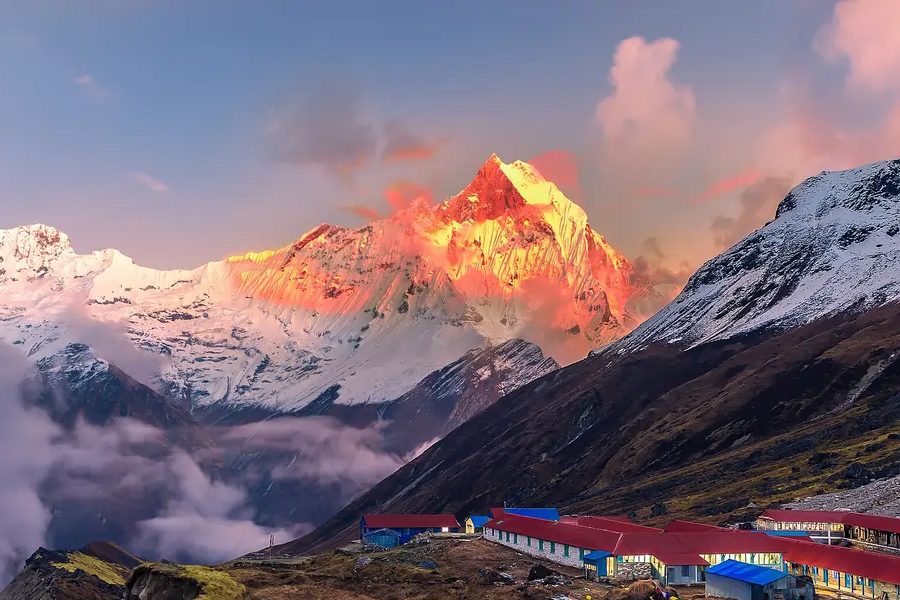
As the altitude increases, the trail becomes more demanding with steep ascents, rocky ridges, boulder sections, and snow-covered summit approaches. The final summit climb is particularly exhilarating and rewards trekkers with magnificent panoramic views of some of the grandest peaks in the Garhwal Himalayas.
The best time to undertake the Pangarchulla Trek is from March to May and again from September to October. During spring and early summer, daytime temperatures generally range between 12°C and 20°C, while nights at higher campsites can drop to nearly -5°C. Snow remains present on the higher meadows and summit sections until late spring, especially during April and early May.
The trek is not recommended during the monsoon months of July and August due to slippery terrain, steep ascents, and frequent rainfall, which can make the route risky and difficult to navigate.
Pangarchulla is considered a moderate to difficult trek and is best suited for trekkers with good physical fitness, stamina, and prior high-altitude trekking experience. Due to the demanding summit climb and high altitude, previous trekking experience above 11000 ft is highly recommended. Proper acclimatization and preparation play a crucial role in ensuring a safe and enjoyable trekking experience.
The trek offers an exceptional combination of adventure, Himalayan wilderness, snow-covered landscapes, and panoramic summit views, making it one of the most rewarding trekking experiences in Uttarakhand.
Your journey begins from Dehradun, where a pickup is arranged early in the morning from Dehradun Railway Station. From here, you will drive towards Lata, the picturesque base village for the Pangarchulla Trek. The road journey covers approximately 293 km and usually takes around 8–10 hours depending on road and weather conditions. Although the drive is long, the route through the Garhwal Himalayas remains incredibly scenic throughout. Dense forests, deep valleys, winding mountain roads, and beautiful river confluences accompany the journey, making the drive an experience in itself. As the route progresses from Haridwar towards the higher Himalayan regions, you will witness spectacular mountain landscapes, rivers cutting through valleys, and panoramic views of the Garhwal range. Nestled amidst misty valleys and towering peaks, Lata offers a peaceful Himalayan atmosphere and serves as the starting point for the trek ahead. Upon reaching the village by evening, trekkers can relax, explore the local surroundings, and experience the traditional culture and cuisine of the region. An overnight stay is arranged at Lata before the trek towards Akhrotghetta begins the following day.
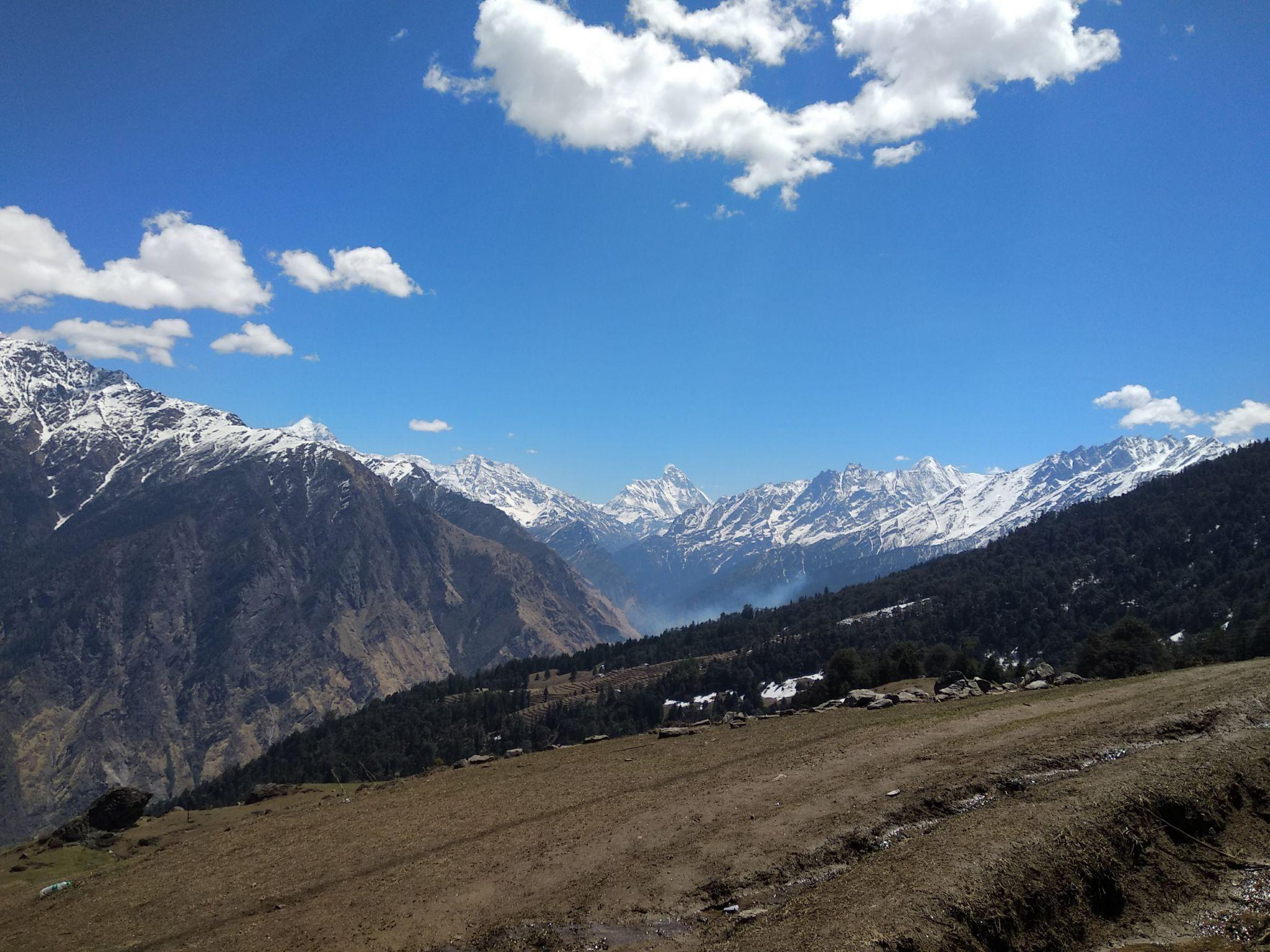
The second day of the Pangarchulla Trek begins early in the morning with breakfast served at the campsite. After breakfast, a short drive takes you from Joshimath to Dhak village, covering a distance of approximately 12 km in nearly an hour. During the drive, you can catch beautiful views of the famous Sleeping Lady Mountain, known for its long, gentle ridgelines resembling a resting figure. The actual trekking trail begins from Dhak village. The trek from Dhak to Akhrotghetta usually takes around 4–5 hours and includes a mix of gradual and steep ascents. The trail passes through small Himalayan villages, streams, and natural water sources where trekkers can refill their bottles along the way. One of the major highlights of the day is the magnificent view of Nanda Devi, which dominates the skyline during much of the ascent. The trail further winds through beautiful forests of oak, hemlock, and rhododendron before opening into the vast alpine meadows of Gorson Bugyal. As you continue higher, stunning views of peaks such as Dronagiri, Chaukhamba, Hathi Parvat, and Gori Parvat begin appearing across the horizon, creating a breathtaking Himalayan panorama throughout the trek. After passing through open meadows and dense forest sections, the trail finally reaches the beautiful campsite of Akhrotghetta. Upon arrival, tents are pitched for the night, followed by dinner and time to relax amidst the peaceful mountain surroundings.
We will be starting the day early with a few minutes of yoga and healthy exercise. After having breakfast at the previous campsite, we will advance to Khullara. The altitude of Khullara is around 11,100 feet. It takes around 5- 6 hours to reach the Khullara campsite. The complete trek distance from Akhrotgetta campsite to Khullara campsite is around 7-8 Kilometres through some green vegetation and really beautiful serene beauty of the hills. The whole trail comprises of dense mountain forests covered with rhododendrons, silver birch and spruce. The magnificent alpine meadows will fill your heart with joy. An uphill trek covering 3 kilometers will take us to lush green meadows where there are well-composed tracks from Tapovan. The panoramic landscapes, wide lush green pastures, frozen ice valleys, and a thrilling advancement of the trail make this journey a memorable one. The last water point is at Forest Hut which is at an elevation of 9,840 feet. The next ascent is quite steep as it connects the forest Hut to Khullara which is located at an elevation of 11,100 feet. You can witness a bunch of snow-clad mountains peaks from here. The mesmerizing views of Nanda Devi, Dronagiri, Hathi Parvat, Gori Parvat, and Chang bang will take make you wonder about your existence. A walk of few distances along a gradual descent will take you to the Khullara campsite. The tents will be pitched, evening snack and tea will be served as you create memories that will last for a lifetime. This will mark the end of day 3. The next day, we will advance to Gailgad from where our destination will become even more closer.
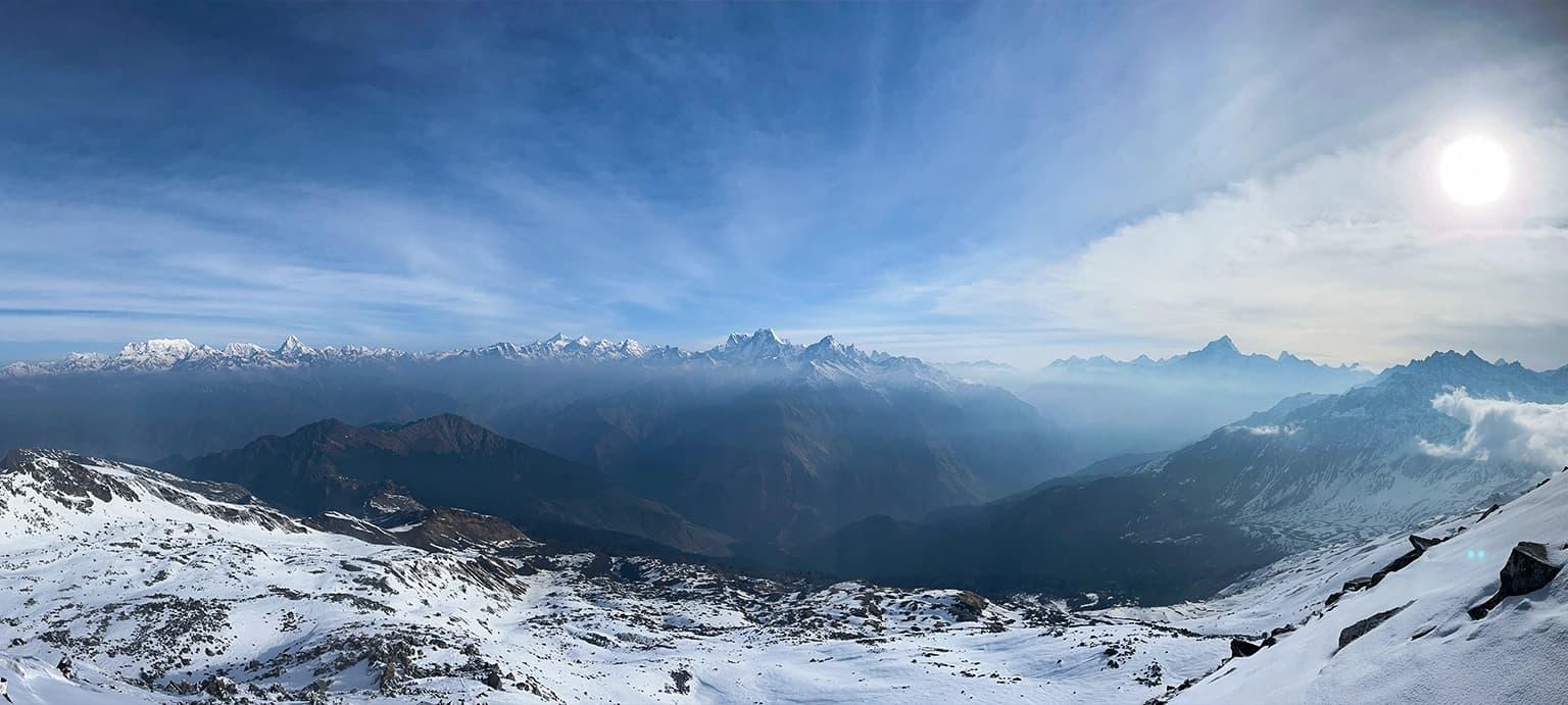
We will be starting the day early. After having a healthy breakfast at Khullara, we will advance to Khullara. The altitude of Gailgad is around 12476 feet. It takes around 3 to 4 hours to reach the Gailgad campsite. From the Khullara campsite, a beautiful forest ridge linking the Lord Curzon Trail snakes along a frozen stream. This part of the trek is blanketed by deep snow. A steep ascent brings you another bridge to climb, revealing a gully right above you. This climb is stiff and steep as you trudge through the powdery snow, moving past the forest line. Another 45 minutes will land you atop the snow gully, where the trail veers to the right and commands views of the massive Pangarchulla peaks. Stick to the right side of the ridge, and continue trekking for about 45 minutes. This is the Advance Base Camp for the trek. On the top of Gailgad, you can enjoy the view of Himalayan peaks including Nanda Devi. There are numerous other elegant mountain peaks namely Kedarnath Peak, Kedar Dome, Chaukhambha, Balakun, Neel Kantha, Mukut Parvat, Kamet, Abhi Gamin, Mana I, Ghori Parvat, Hathi Parvat, Dronagiri, Kalinka, Chang Bang, and Nanda Ghunti. You will feel like you are in heaven being surrounded by these many mountain peaks in the vicinity. We will spend some time embracing the beauty of the setting and glorifying the magnificence of nature. We will set camp here for the night. Dinner will be served at the campsite. Tents will be pitched and fun activities will be organized. The following day will be the day when we will trace the Pangarchulla summit and make history for ourselves.
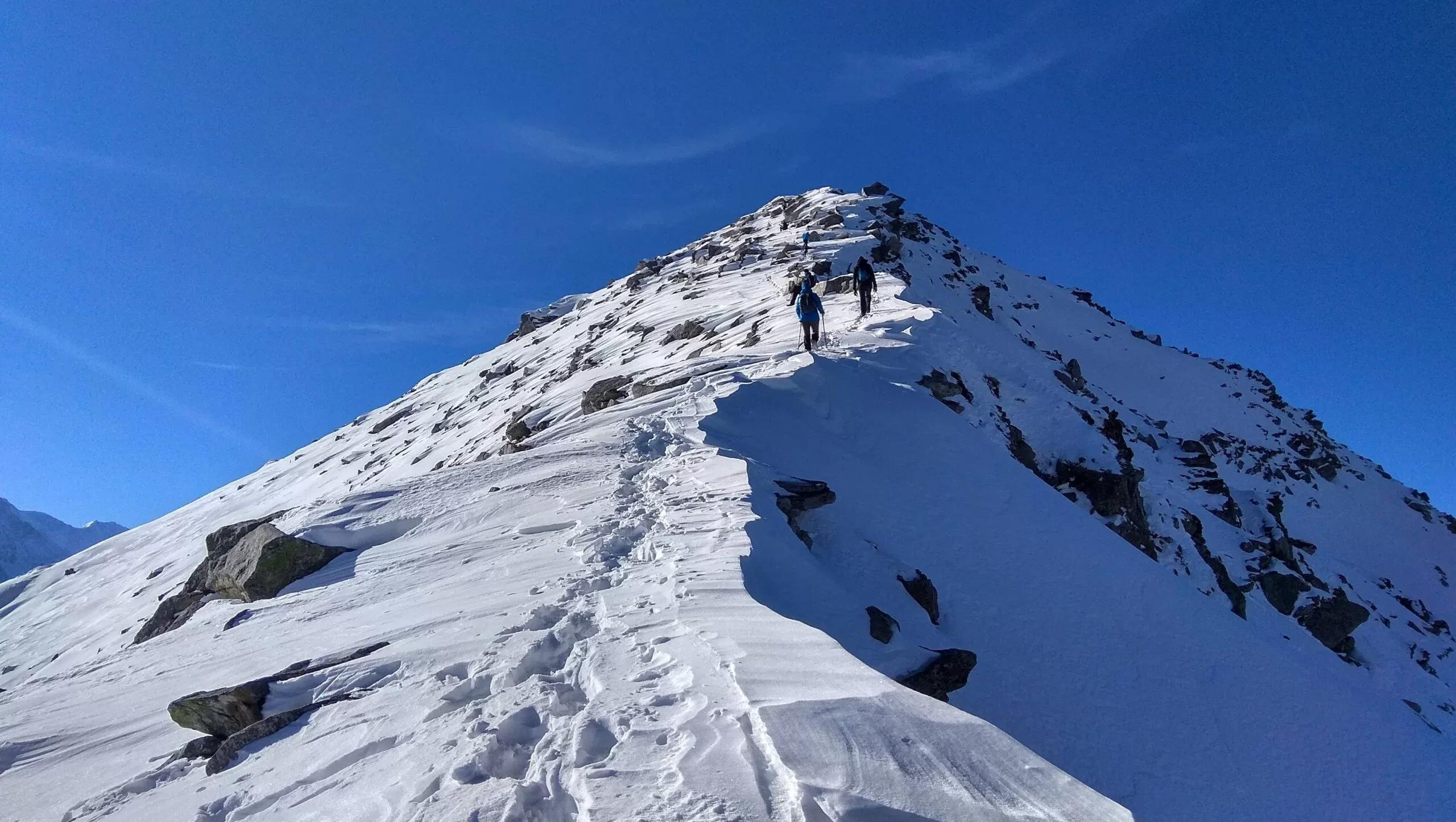
This is the most exciting and challenging day of the Pangarchulla Trek as you make your way towards the Pangarchulla Summit, situated at an elevation of approximately 15070 ft above sea level. The day’s trek is demanding and usually takes around 10–12 hours to complete, making it essential to start early and carry sufficient water, as there is only one major water point about 3–4 hours into the climb. The summit push begins before sunrise as the trail gradually ascends through deep snow-covered terrain. Proper winter gear, including gaiters and crampons, becomes essential during this section, especially in winter when the snow can become extremely slippery. The route involves steep ascents, narrow ridges, and continuous undulating terrain that tests both stamina and endurance. As you gain altitude, the climb becomes steeper and more technical. Near the final summit section, trekkers encounter a challenging snow wall inclined at nearly 60 degrees, where the use of ice axes becomes necessary for a safe ascent. Despite the physical demands, the thrill of climbing through snow and rugged Himalayan terrain makes this stretch incredibly rewarding. After hours of effort, the Pangarchulla Summit finally reveals breathtaking panoramic views of the snow-covered Garhwal Himalayas. The spectacular 360-degree views from the summit create one of the most unforgettable moments of the trek, making every challenging step worthwhile. After spending some time at the summit and capturing the incredible scenery, the group descends back towards the campsite for lunch. Since this is the longest and most exhausting day of the trek, the evening is kept relaxed with dinner served at camp followed by an early overnight rest amidst the peaceful Himalayan wilderness.
Today’s trek from Gailgad to Auli is primarily a descent through dense forests of oak and rhododendron, with a few steep sections along the route. Since there is only one major water point approximately 3 hours into the trek, trekkers are advised to carry at least 2 litres of water while departing from the campsite. The trail gradually winds through peaceful forest landscapes before opening into beautiful alpine meadows where a packed lunch is usually enjoyed amidst the serene Himalayan surroundings. Continuing further downhill, the route eventually reaches the motorable roads of Auli. Auli is widely known as the skiing capital of India and is famous for its snow-covered slopes and panoramic Himalayan views. The calm atmosphere, scenic meadows, and pristine surroundings of Auli create a peaceful mountain retreat after the demanding summit climb of the previous day. The ski resort at Auli is managed by Garhwal Mandal Vikas Nigam (GMVN), which also conducts skiing courses during the winter season. Travelers interested in skiing can participate separately, as these activities are generally not included in the trekking package. From Auli, pre-arranged vehicles transfer trekkers to Joshimath, located approximately 13 km away. Upon reaching Joshimath, trekkers can relax with evening tea followed by a short debriefing session about the trek. Dinner is served later in the evening, and the night is spent at Joshimath. After several days in the mountains, Joshimath also marks the return of reliable mobile connectivity, allowing trekkers to reconnect with family and friends and share memories from the incredible Himalayan journey.
This marks the final day of the Pangarchulla Trek as you begin the drive back from Joshimath to Dehradun. The journey covers approximately 293 km and usually takes around 10 hours, depending on road and weather conditions. Although the drive is long, the route remains incredibly scenic throughout, offering beautiful views of river valleys, mountain roads, forests, and Himalayan landscapes. Along the way, you will witness several famous river confluences that hold both geographical and spiritual significance in Uttarakhand. The route passes through Karnaprayag, where the Pindar River meets the Alaknanda River. Further ahead lies Rudraprayag, known for the confluence of the Mandakini River and the Alaknanda River, and also regarded as an important gateway towards Kedarnath. Continuing onward through Srinagar, the journey finally reaches Devprayag, where the crystal-clear waters of the Bhagirathi River and the Alaknanda River merge to form the sacred Ganga River. As the mountains slowly fade behind the roads leading back to Dehradun, memories of snow-covered peaks, alpine meadows, forest trails, and Himalayan sunrises continue to stay with you. The Pangarchulla Trek leaves behind not just photographs and stories, but also a deep connection with the mountains and a longing to return once again to the Himalayas.
Pangarchulla Summit is a high-altitude Himalayan trek. The level of this trek is difficult, which demands physical fitness, stamina, and endurance. Prior trekking experience of scaling at least 11,000 feet is required, which means beginners are not recommended for this trek. The duration of the trek is 7 days, and it covers a total distance of around 46 kilometers. You will come across steep slopes and risky ridges along the trail. Most of the route passes through dense forests. The trek can become more difficult during the winter months when heavy snowfall submerges large sections of the trail.
Pangarchulla Trek is a high-altitude Himalayan trek that demands around 7 days of trekking. The difficulty level of this trek is considered challenging and requires good physical fitness, stamina, and endurance. Prior trekking experience is essential, which means this trek is not recommended for beginners. It is advisable to prepare yourself physically before the trek by doing basic exercises such as jogging, stretching, sit-ups, and similar workouts for at least 1–2 weeks prior to the journey. Additionally, increasing your stamina by walking 4–5 kilometers daily during the preparation period can be highly beneficial. Maintaining a positive mindset and staying physically and mentally fit will help you enjoy the beautiful Pangarchulla Trek to the fullest and return with unforgettable memories of the Himalayas.
Pangarchulla Summit Trek is a high-altitude Himalayan trek. The difficulty level of this trek is considered challenging and demands excellent physical fitness, stamina, and endurance. Prior trekking experience is essential, which means this trek is not recommended for beginners. The trek spans around 7 days and covers a total distance of approximately 44 kilometers. Along the route, trekkers encounter steep ascents, narrow ridges, and demanding terrain sections. During the winter months, the trek becomes even more challenging as heavy snowfall covers large parts of the trail and nighttime temperatures drop significantly. Due to the demanding nature of the summit climb and high-altitude conditions, Pangarchulla is regarded as one of the tougher Himalayan treks and is best suited for experienced trekkers.
During the winter months, temperatures at Pangarchulla Summit often fall below 0°C, with minimum temperatures dropping to nearly -10°C or even lower. Heavy snowfall during this period blankets the entire region in snow, transforming the trail into a challenging yet breathtaking Himalayan landscape. For the rest of the year, the weather remains comparatively pleasant. During the summer months of April and May, daytime temperatures generally range between 12°C and 20°C, while nighttime temperatures can still fall to around -5°C at higher altitudes. Snow can often be found accumulated on the alpine meadows and near the Pangarchulla Summit even during late spring. The monsoon months of July and August usually bring rainfall and overcast weather conditions, with dense cloud cover dominating the region. Trekking during this period is generally not recommended due to slippery trails and reduced visibility.
Pangarchulla Summit stands tall at an elevation of approximately 15,000 feet above sea level. The best time to undertake the Pangarchulla Summit Trek is from April to May, when the snow gradually begins to melt, creating stunning landscapes and pleasant trekking conditions. The trek can also be attempted during snowy conditions, although it becomes more challenging in winter as large sections of the trail remain covered under deep snow. Despite the increased difficulty, the winter scenery is truly spectacular. One of the major highlights of the trek is witnessing the surrounding hills and valleys blanketed in snow, along with breathtaking views of the snow-covered peaks of the Garhwal Himalayan range.
Pangarchulla Summit lies at a high altitude in the lap of the Himalayas. The best time to undertake the Pangarchulla Trek is from March to May and again from September to October, just before the onset of winter. During peak winter, heavy snowfall makes the trek significantly more challenging. In the summer months of April and May, daytime temperatures generally range between 12°C and 20°C, while nighttime temperatures can drop as low as -5°C at higher campsites. Snow can still be found on the alpine meadows and near the Pangarchulla Summit during this period, adding to the beauty of the trek. One of the major highlights of the trek is the stunning view of the snow-covered Garhwal Himalayan peaks and the surrounding valleys blanketed in snow. Make sure to carry a good camera or smartphone, as the breathtaking landscapes throughout the trek are truly worth capturing.
Pangarchulla Summit Trek is a high-altitude Himalayan trek, and proper preparation is essential for a safe and comfortable trekking experience. Make sure you carry all the necessary trekking essentials, including a rucksack, 2 pairs of quick-dry T-shirts and trekking pants, 2 pairs of socks, trekking shoes, a fleece jacket, sunscreen with SPF 50+, a towel, lip balm, a headlamp or torch, 1-liter water bottles, and any personal medications you may require. For a complete packing guide, you can download the detailed checklist from the footer section. Ensure that all the required gear and essentials are packed before the start of the trek.
One thing for sure, you won't have to worry about the food on this trek. We can assure you that the food served on this trek will be one of the best that you might have encountered throughout your life. Generally, only vegetarian food is served on a trek because non-vegetarian food has a high amount of protein which makes it difficult to digest. We have a serving of 4 meals per day which includes breakfast, lunch, evening snacks, dinner. We don't compromise on the quality of the food. Hence, all you need to do is explore the beauty of the trek without worrying about the food.
Pangarchulla Summit Trek is a long 7-day Himalayan trek, and therefore carrying proper backpacks, rain protection, and trekking essentials is extremely important. Backpacks, raincoats, and most other trekking equipment will not be available for rent from our side, so trekkers are required to bring these items themselves. We recommend checking the detailed checklist available on our website to ensure that you carry all the necessary gear required for the trek. Proper preparation and packing will help make your trekking experience safer and more comfortable. The only accessories available for rent during this trek are trekking poles and ponchos. All other essential trekking equipment and personal items must be arranged individually before the start of the journey.

Member Since 2026